Our Community

Areas marked are not exact. Data was found on Weber County Planning Department Gizmo and Frontier. Parcels in red diagonal have been approved in the last three years. Blue diagonal lines are owned by companies which do not have traditional community family names attached to the ownership of the land and it is assumed they are planning on developing in the area. The following information was extrapolated from the Feasibility Study for West Weber, 2019.
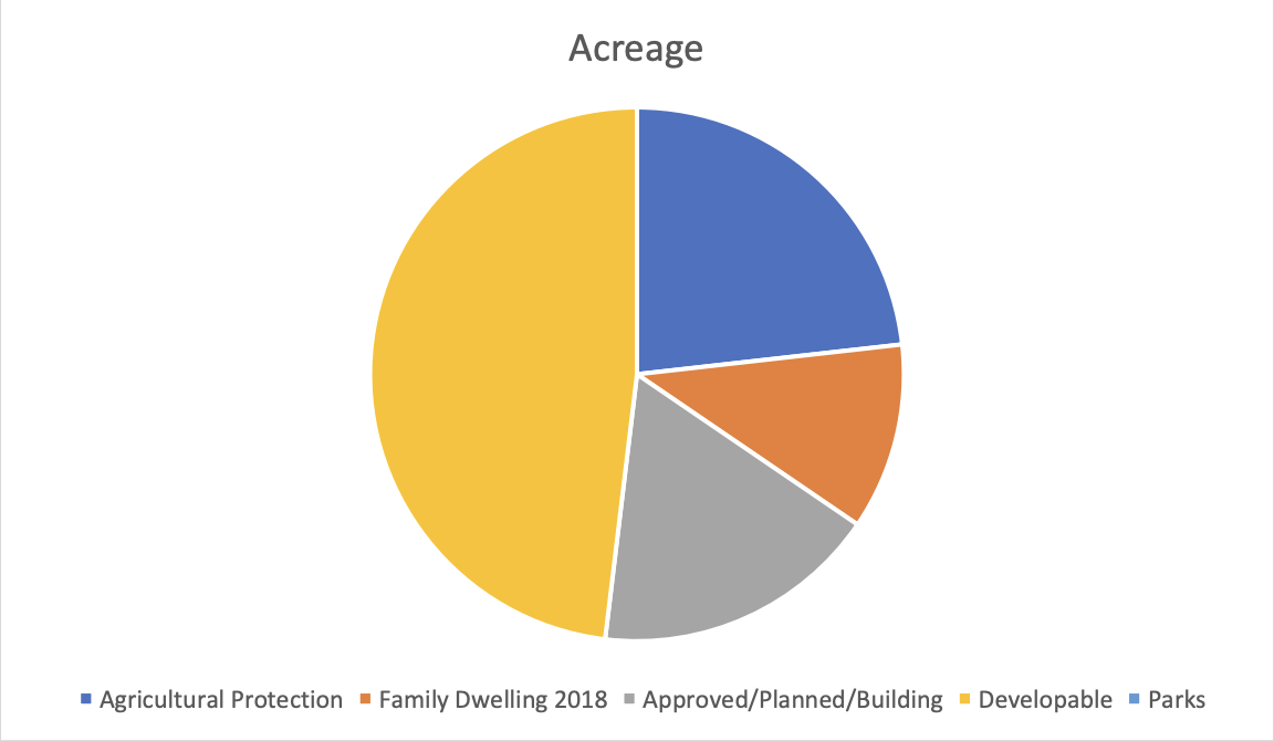
14 sections of land = 8,960 acres
Approximately 3.25 sections in Agricultural Protection = 2,080 acres
23% of land in Agricultural Protection
Housing Development: Existing Subdivisions and homes In 2019feeasiblilty study = 1013 Homes
2018 Feasibility study concluded there were 3.25 individuals per household which would give a population of 3351
In the past three years 2018-2021, Western Weber planning Commission have approved 1558 new single-family residences
At an average of 3.25 persons per residence – 5063 induvial added to our population. (Though many of the homes are young families with 3+ children which would take that number to 7,790
| Existing parks in the Park District: | |||
|---|---|---|---|
| Taylor Landing | 9.5 acres | undeveloped, no water | |
| West Weber LDS Park | 4.3 acres | (Private owned) | |
| Taylor LDS Park | 3.5 Acres | (Private Owned) | |
| Staker Park (West Haven) | 6.2 Acres | ||
| Total Park Area | 23.5 |
We have no approved trails or pathways in the two-community area.
In 2022 the West Weber and Taylor Communities has 0.0036 per cent of total land area dedicated to Parks for the emotional, social, and physical welfare of the community.

